Wilson, NC
Wilson Map
Wilson is a city and the county seat of Wilson County in the Coastal Plain region of the U.S. state of North Carolina. The 17th largest city in the state, Wilson had a population of 50,652 according to the 2007 estimate.
Wilson is located at 35°43?52?N 77°55?25?W / 35.73111°N 77.92361°W / 35.73111; -77.92361 (35.731093, -77.923509).
According to the United States Census Bureau, the city has a total area of 23.4 square miles (60.7 km²), of which, 23.3 square miles (60.3 km²) of it is land and 0.2 square miles (0.4 km²) of it (0.64%) is water.
Nearby cities include Stantonsburg, Sharpsburg, Bailey, Fremont, Macclesfield.
Places in Wilson
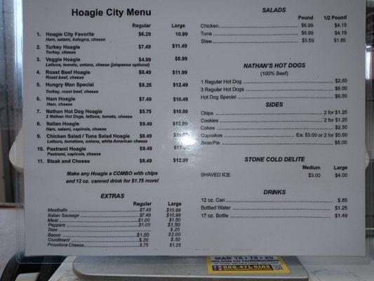
Dine and drink
Eat and drink your way through town.


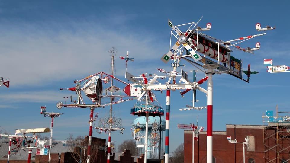
Can't-miss activities
Culture, natural beauty, and plain old fun.


Places to stay
Hang your (vacation) hat in a place that’s just your style.