Centennial, CO
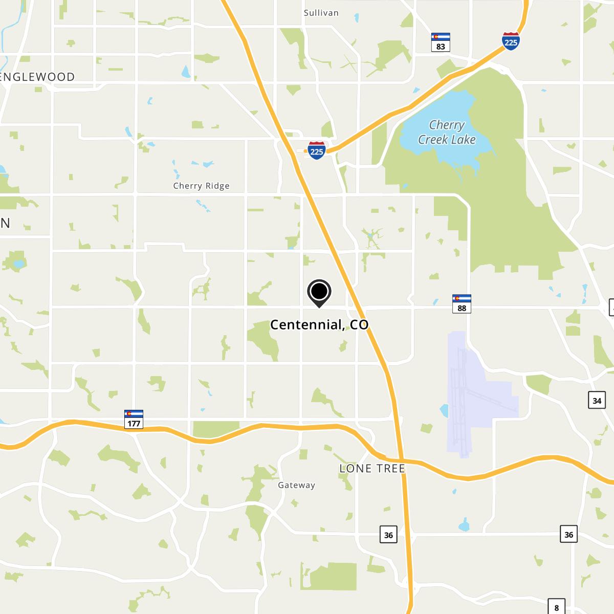
Centennial, CO Map
Centennial is a US city in Arapahoe County in the state of Colorado. Located at the longitude and latitude of -104.843889, 39.596389 and situated at an elevation of 1,777 meters. In the 2020 United States Census, Centennial, CO had a population of 108,418 people. Centennial is in the Mountain Standard Time timezone at Coordinated Universal Time (UTC) -7. Find directions to Centennial, CO, browse local businesses, landmarks, get current traffic estimates, road conditions, and more.
Centennial, located in Colorado, is a relatively young city, officially incorporated in 2001. Despite its recent establishment, Centennial has quickly become known for its family-friendly atmosphere and an abundance of outdoor recreational opportunities. The city is home to the expansive Cherry Creek State Park, which offers a variety of activities such as hiking, biking, and boating, making it a popular destination for both residents and visitors. The park's natural beauty and wildlife provide a serene escape from urban life.
In addition to its outdoor offerings, Centennial boasts the Streets at SouthGlenn, a vibrant shopping and dining district that combines retail, entertainment, and residential spaces. This area is a favorite among locals for its diverse selection of shops, restaurants, and seasonal events. Centennial's commitment to community and quality of life is evident in its well-maintained parks, trails, and public spaces, making it a desirable place to live and visit.
Nearby cities include: Dove Valley, CO, Inverness, CO, Foxfield, CO, Cherry Creek, CO, Cottonwood, CO, Greenwood, CO, Lone Tree, CO, Parker, CO, Highlands Ranch, CO, Aurora, CO.
Map of Centennial, CO

Places in Centennial
Dine and drink
Eat and drink your way through town.
Can't-miss activities
Culture, natural beauty, and plain old fun.
Places to stay
Hang your (vacation) hat in a place that’s just your style.


