Flerehei

tripadvisor logo

(1)

Call

Photos

4440
Starting point: Turn off Highway 468 at Lunde church in the direction of oyne. Drive over the bridge and park at the first farm on the right. Description:The hike begins at a small farm in the oyes. From here follow the forest road to the summit allowing approximately an hour for the steep ascent. At the top, where the road travels down towards the Midtstolsvatnet, turn right and follow the red markers up Glovreknuten. Initially in a south-easterly direction over the flat areas, then up in a southerly direction. After about 15 minutes, cross a stream here the path runs east through the marsh area. At the end of the moor the trail continues up a small hill. During the climb, you will see a small lake on your left. Once at the top you will see the path again carrying on in a southerly direction throught the hillltops. On the flatter section you have to cross a bog and then you will come to a small lake on the left handside. Continue in the same direction until you reasch a small cavern now you have the top of Glovreknuten on your right. On top of the cavern you will see directly on Flerehei. Continue down the hilly landscape, you will pass a lake on the right handside, and shortly after you cross a stream between two lakes. Follow the stream on the left side of a small knoll, from which you walk on the left side of the lake before embarking on the final climb to Flerehei. First travel through a small valley with large stones, then zig zag up a small hill, before the last gentle climb over the bog and heath to the crash site. A memorial monument stands a short distance up from the aircraft remains. For a detailed description including maps and information etc buy the guidebook 'Hiking in Sirdal' which includes Kjerag and Sirdals Seven Summits.

Reviews

tripadvisor logo
4.01 reviews
Photo of LilleSille
One of the toughest start on any hike ever
6/16/2014

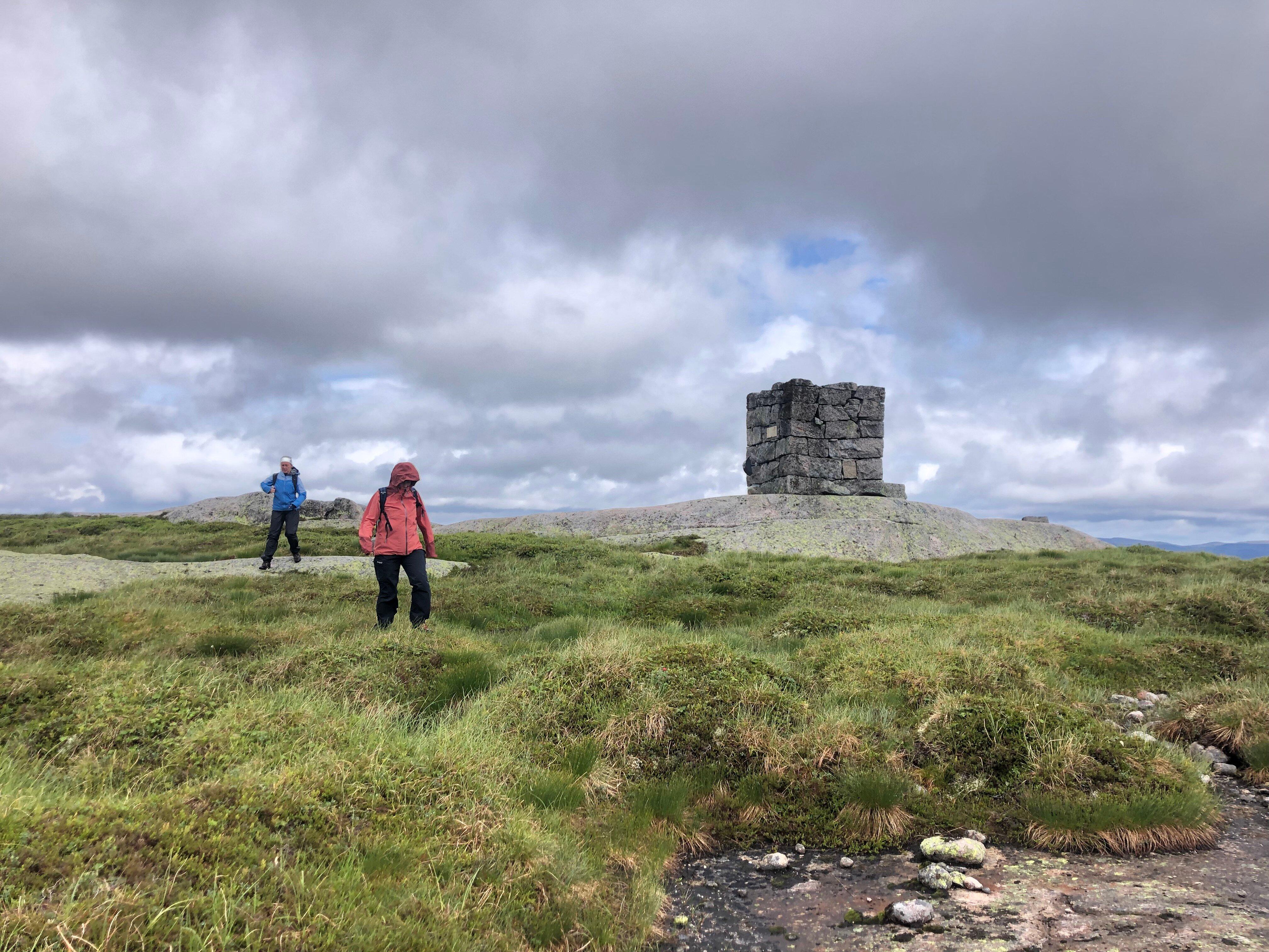
The crash site at Flerehei is well worth a visit, as it brings some history into the hike. However...

Own this business?
See a problem?

You might also like

Bergehei

Bergehei

Starting point: from the center of Tonstad head towards Josdal. Park in the parking lot at Josdalstippen, which is after the 'Indre Skjorbutjodn' on the right. Remember it is pay and display so don't forget your change. Route Description: from the carpark continue to walk across the narrow paved road. After about 10 minutes, the road splits, turn right on to the dirt road in a southerly direction. Follow the gravel road upto the cabin area, after an additional 10 minutes the road will end at a private parking space. Continue along the path upwards following the stream. After approximately 10 minutes of climbing on rocky terrain the terrain changes and alternates from marsh land to heather and then the ground splits so keep to the right. Cross the marsh at the north tip of the Magevatnet and walk along/parallel with the northernly Magevatnet which will be on the left handside. At the end of the northern lake turn east (to your left) and the route between the two lakes. Walk over a bridge, before turning south along the southern Magevatnet which will now be on your right handside. At the end of the lake another path crosses yours, here, go southeast along the creek down the left side. First on the rocks, then over the marsh. The trail not visible because of the marshlands but after about 7 minutes walk, turn left a short distance, until you see a cabin on your left handside. From here continue south east around a small hill until you come to two farm buildings. From the farms continue in the same direction up a small glen until you come to a swamp and the terrain flattens out. Turn north (left) along the narrow path travel up Budals rise. You will pass a small tarn on the right handside, and after about 20 minutes walking the path splits, here turn southeast (right) along the edge of the mountain. After about 10 minutes, leave the trail, try and find your own way up the mountain to the summit, which is about 20 minute walk in an easterly direction. You will walk for some distance on this beautiful pathway before the top, and from here you have 360 degree views of both the northern and southern Sirdal moors, Kvinesdal, as well as Lyngdal (south).
Haugen to Fidjeland

Haugen to Fidjeland

1
Starting point: Start on foot or take a taxi from Haugen Hytteutleie og Camping to the large rock by the barrier Honedalen (3.8 km). The trail begins just after the barrier. Description:The path starts at a large rock by the barrier in Honedalen valley where you head off in a northern direction. After a 5-10 minute walk you will reach Honetjodn where there is a lovely welcoming beach for hot summer days! Continue around the tarns turning north-east towards Honestol and then from here in a northernly direction up Urdalsskaret. Allow 30 minutes to the top, before you begin the descent to Finnstol (10 minutes). Continue north to Finnstoldalen, along the left side of the stream. The stream becomes livelier the further north you walk. Soon you will see the jagged mountains of Svartups mountain and Jogledalen valley on your right handside. At the holiday cabins at Smolasen, you come to a sheep fence with a gate enabling you to pass easily. Remember to close the gate behind you! After a few minutes you will come to a road that leads up to the cabins (Smolasen). Follow it until you reach a bridge where you can safely cross the Joglaelven river and walk up to Sirdal Hoyfjellshotell. Alternatively, you can continue straight ahead to Fidjeland Hytteutleige (cabin rental) You can see the Degdammen dam on the way down. It was built between 1968 and 1970 and is 90 metres high. The crown of the dam is 390 metres. The dam is a rock-fill dam where moraine has been used. The moraine comes from the housing development at Fidjeland. For a detailed description including maps and information etc buy the guidebook 'Hiking in Sirdal' which includes Kjerag.
NorwayFlerehei